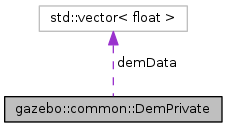
Private data for the Dem class. More...
#include <common/common.hh>

Public Attributes | |
| GDALRasterBand * | band |
| A pointer to the band. More... | |
| GDALDataset * | dataSet |
| A set of associated raster bands. More... | |
| std::vector< float > | demData |
| DEM data converted to be OGRE-compatible. More... | |
| double | maxElevation |
| Maximum elevation in meters. More... | |
| double | minElevation |
| Minimum elevation in meters. More... | |
| unsigned int | side |
| Terrain's side (after the padding). More... | |
| double | worldHeight |
| Real height of the world in meters. More... | |
| double | worldWidth |
| Real width of the world in meters. More... | |
Private data for the Dem class.
| GDALRasterBand* gazebo::common::DemPrivate::band |
A pointer to the band.
| GDALDataset* gazebo::common::DemPrivate::dataSet |
A set of associated raster bands.
| std::vector<float> gazebo::common::DemPrivate::demData |
DEM data converted to be OGRE-compatible.
| double gazebo::common::DemPrivate::maxElevation |
Maximum elevation in meters.
| double gazebo::common::DemPrivate::minElevation |
Minimum elevation in meters.
| unsigned int gazebo::common::DemPrivate::side |
Terrain's side (after the padding).
| double gazebo::common::DemPrivate::worldHeight |
Real height of the world in meters.
| double gazebo::common::DemPrivate::worldWidth |
Real width of the world in meters.