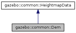
#include <Dem.hh>
| gazebo::common::Dem::Dem |
( |
| ) |
|
| virtual gazebo::common::Dem::~Dem |
( |
| ) |
|
|
virtual |
| void gazebo::common::Dem::FillHeightMap |
( |
int |
_subSampling, |
|
|
unsigned int |
_vertSize, |
|
|
const math::Vector3 & |
_size, |
|
|
const math::Vector3 & |
_scale, |
|
|
bool |
_flipY, |
|
|
std::vector< float > & |
_heights |
|
) |
| |
|
virtual |
Create a lookup table of the terrain's height.
- Parameters
-
| [in] | _subsampling | Multiplier used to increase the resolution. Ex: A subsampling of 2 in a terrain of 129x129 means that the height vector will be 257 * 257. |
| [in] | _vertSize | Number of points per row. |
| [in] | _size | Real dimmensions of the terrain in meters. |
| [in] | _scale | Vector3 used to scale the height. |
| [in] | _flipY | If true, it inverts the order in which the vector is filled. |
| [out] | _heights | Vector containing the terrain heights. |
Implements gazebo::common::HeightmapData.
| double gazebo::common::Dem::GetElevation |
( |
double |
_x, |
|
|
double |
_y |
|
) |
| |
Get the elevation of a terrain's point in meters.
- Parameters
-
| [in] | _x | X coordinate of the terrain. |
| [in] | _y | Y coordinate of the terrain. |
- Returns
- Terrain's elevation at (x,y) in meters.
Get the georeferenced coordinates (lat, long) of the terrain's origin in WGS84.
- Parameters
-
| [out] | _latitude | Georeferenced latitude. |
| [out] | _longitude | Georeferenced longitude. |
| unsigned int gazebo::common::Dem::GetHeight |
( |
| ) |
const |
|
virtual |
Get the terrain's height.
Due to the Ogre constrains, this value will be a power of two plus one. The value returned might be different that the original DEM height because GetData() adds the padding if necessary.
- Returns
- The terrain's height (points) satisfying the ogre constrains (squared terrain with a height value that must be a power of two plus one).
Implements gazebo::common::HeightmapData.
| float gazebo::common::Dem::GetMaxElevation |
( |
| ) |
const |
|
virtual |
| float gazebo::common::Dem::GetMinElevation |
( |
| ) |
const |
Get the terrain's minimum elevation in meters.
- Returns
- The minimum elevation (meters).
| unsigned int gazebo::common::Dem::GetWidth |
( |
| ) |
const |
|
virtual |
Get the terrain's width.
Due to the Ogre constrains, this value will be a power of two plus one. The value returned might be different that the original DEM width because GetData() adds the padding if necessary.
- Returns
- The terrain's width (points) satisfying the ogre constrains (squared terrain with a width value that must be a power of two plus one).
Implements gazebo::common::HeightmapData.
| double gazebo::common::Dem::GetWorldHeight |
( |
| ) |
const |
Get the real world height in meters.
- Returns
- Terrain's real world height in meters.
| double gazebo::common::Dem::GetWorldWidth |
( |
| ) |
const |
Get the real world width in meters.
- Returns
- Terrain's real world width in meters.
| int gazebo::common::Dem::Load |
( |
const std::string & |
_filename = "" | ) |
|
Load a DEM file.
- Parameters
-
| [in] | _filename | the path to the terrain file. |
- Returns
- 0 when the operation succeeds to open a file.
The documentation for this class was generated from the following file:

 Public Member Functions inherited from gazebo::common::HeightmapData